Wednesday, April 17, 2013

The Climate of Costa Rica


The climate of Costa Rica is divided into two major seasons: wet and dry. The dry season typically runs from January to April and the wet season typically runs from May to November. The classifications of the seasons as wet versus dry are the amount of precipitation recorded. The average precipitation can differ depending on location. As of last year Costa Rica averaged 77.6 inches of precipitation. Different regions within the country receive more precipitation opposed to others.  Guanacaste received 94.6 inches of precipitation last year, which is relatively low, compared the highlands of Monteverde home of the “Cloud Forest” that received 144.9 inches of precipitation.
This graph above shows temperature, precipitation, and humidity in San Jose, Costa Rica. Courtesy of Google Images.

 The cloud forest of Monteverde is an incredible phenomenon where walls of mist flow through the Tilarán Mountain Range. These walls of mist are brought from the coast into the highlands from the Northeast Trade Winds. Costa Rica is situated between 8 degrees and 11 degrees north latitude. Costa Rica lies within the Intertropical Convergence Zone (ITCZ). ITCZ is where the northeast and southeast trade winds meet in a low-pressure zone. Solar heating causes the air to rise and results in an abundance of precipitation. The trade winds blow from about 11-13 miles per hour and push the clouds that are full of precipitation from the coast to the nearby highlands. The clouds are low-level clouds that drift through the canopy layer of the forest and mist.

The Monteverde Cloud Forest. The low-level cloud lay upon the forest's canopy layer and mist. Photo Courtesy of Google Images.

 El Niño Southern Oscillation (ENSO) was said to have an effect on Costa Rica a couple of years ago. ENSO refers to differences in the surface of the Pacific Ocean off of the west coast of South America and air surface pressure. The changes in temperature in the water from warm (El Niño) to cool (La Niña) are known to cause climate changes, for example, flooding or droughts.  Scientists have stated that the affects of ENSO changed Costa Rica’s climate and might be the main factor in the extinction of several rare species of frogs.  

The Golden Toad of Costa Rica was a rare frog species that is said to be extinct due to the sudden drought in the cloud forest theoretically caused by ENSO. Photo Courtesy of Google Images.
Sources:

  • http://www.worldheadquarters.com/cr/climate/
  • http://www.costaricaexpeditions.com/AboutCR/tempchart.php
  • http://geography.about.com/od/climate/a/itcz.htm
  • http://geography.about.com/od/climate/a/itcz.htm
  • http://geography.about.com/od/physicalgeography/a/tradewinds.htm
  • http://en.wikipedia.org/wiki/El_Niño–Southern_Oscillation
  • Dr. Allen's Lectures

Saturday, March 9, 2013

Costa Rica's Mass Wasting and Soil


Mass Wasting:

Heavy rains and the rich volcanic soils of Costa Rica make it a promise land for agriculture. The permeable slopes absorb water and make the land sustainable for growing food. This is other wise known as a transport limited landscape. Due to excessive rain during Costa Rica's rainy season (November - May) mass wasting is known to occur. Mass wasting is a downslope movement of angular material.
The photo above demonstrates a mudflow that occurred in December 2011.  The rain caused a release in the colluvium (angular slope material) and brought down mud and grasses.

debris flow contains mud, boulders, and cobble. In 2010 this debris flow destroyed a small village.
Photo Source: Getty Images


In 2010 Costa Rica received excessive amounts of rain. At one time it rained 6.3 inches in two hours. This storm caused landslides across the country. The extreme rain caused the Pico Blanco mountains to soften and induce a major debris flow. Trees, mud, and boulders were swept away and stacked about 10 feet high at the end of the flow. The intense amounts of rain also caused a breach in a dam in Parrita. 

2010 Debris Flow. Photo Source: Getty Images

Soil:

The climate largely affects the soil. A majority of Costa Rica is rain forests and a large percentage of rainfall they receive per year really affects the soil. The soil becomes nutrient poor because of leaching due to the abundance of rainfall.  Leaching refers to the loss of soluble substances such as salt or nutrients. In this case leaching is the loss of nutrients in the soil. This action leads to very impoverished soils, causing aluminum and iron to accumulate; this process is referred to as laterization. The soil is normally a deep red color and the soil is classified as an oxisol

This is a picture of slashing and burning or swidden of a forest in Costa Rica, with the trees removed you can see the oxisol (deep red soil). Photo Source: Google Images

Without nutrients in the soil the tremendous amount of plant and tree growth comes from the vegetation. The rainforest's cycle of nutrients in rapidly changing. The decaying organic matter (dead wood, leaves and plants) are decomposed very quickly by bacteria, fungi termites, etc. that the organic matter never makes it past the O Horizon (the surface layer that contains living and decaying organic matter) and into the soil. The rapidly broken down nutrients are quickly taken up by plants and trees waiting for the cycle to begin again.


Sources:


Sunday, February 17, 2013

Costa Rica's Volcanism


Hola Readers,

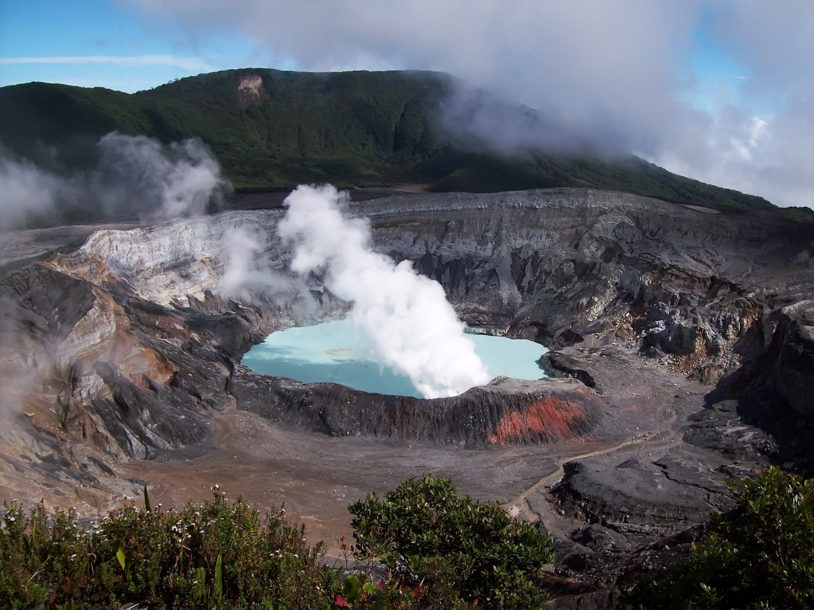
This is my view of the Poás Volcano from when I visited.
Welcome to San Jose! Today we are going to explore outside of the city in Poás National Park, this is the home of the Poás Volcano. The Poás Volcano is a stratovolcano also known as a composite volcano. It is made up of many layers. These layers or strata are composed of hardened lava, tephra, pumice and volcanic ash. The Poás Volcano is currently active and has erupted 39 times since 1828. The volcano was once very explosive and now has many craters. Near the summit of Poás there are two crater lakes the most famous lake is called Laguna Caliente (“Hot Lagoon”) it is known to be one of the most acidic lakes in the world.  The lake sometimes reaches a pH level of almost zero.
On Average this is the view of the Poás Volcano.

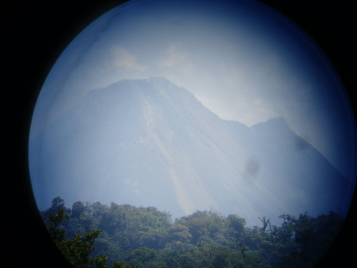
Next stop is the Arenal Volcano. The Arenal Volcano is an active andesitic stratovolcano. It is a mix of MAFIC/FELSIC the Arenal Volcano has the cinder cone shape but it also very explosive.  Andesite is an extrusive, igneous, volcanic rock and is a characteristic of subduction zones. The Arenal Volcano is famous for it’s nighttime show of spitting lava into the sky. Most volcanoes in Central America have very thick, viscous lava that is filled with gases and this causes the more violent explosions when they erupt. 

The Arenal Volcano from up close!
This is a picture of the Arenal Volcano that I took using binoculars.
 
The nighttime light show of the Arenal Volcano

So how are these volcanoes formed? The volcanoes in Costa Rica are formed by subduction. The western side of the Caribbean plate subducts the Cocos plate located in the Pacific Ocean.  The more dense Cocos plate currently moves about 10 centimeters per year. 

I hoped this gave you some information about two very interesting volcanoes in Costa Rica. Until next time!

Adios,

Danielle